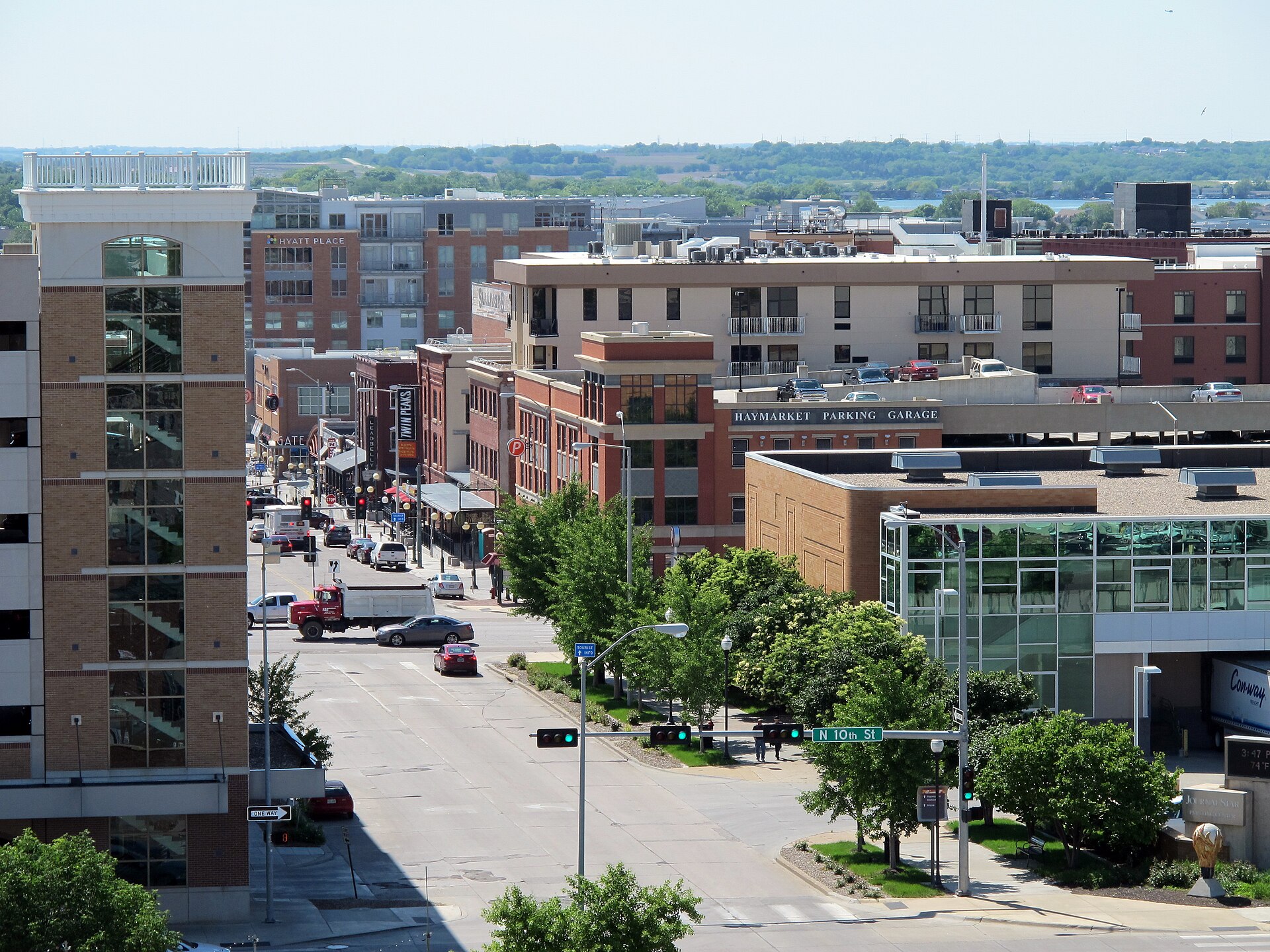
The Haymarket and West Haymarket from above

Outdoors

Hiking near Lincoln

National forests, parks, lakes and recreation areas with hiking trails near Lincoln, closest first.

16places to hike
3 mito the closest
3within 30 miles
March–May, September–Novemberbest months

Good to know: Carry more water than you think you need, check the managing agency’s page for trail closures and fire restrictions, and start early on hot days.

Closest picks

1

Holmes Lake

3 mi southeast · US Army Corps of Engineers

Holmes Lake, NE is a 112-acre lake located on Antelope Creek within the city of Lincoln, NE. Recreational opportunities at Holmes include fishing, hiking, biking, picnicking, and golfing. This park is managed by the City of Lincoln, NE.

2

Branched Oak Lake

14 mi northwest · US Army Corps of Engineers

Branched Oak, NE, a State Recreation Area located 4 miles west of Raymond, NE on Oak Creek, boasts some of the finest camping facilities in the State Park system. There are 268 campsites - 187 of which have electrical hook-ups.

3

Twin Lakes

14 mi west · Bureau of Reclamation

Located 14 miles west of downtown Lincoln, northeast and 3 miles north of Pleasant Dale, NE. Take exit #388 from I-80.

Map of all 16 places

Map of 16 places loads as you scroll.

Within 30 miles (3)

3 mi southeast · US Army Corps of Engineers

Holmes Lake

Holmes Lake, NE is a 112-acre lake located on Antelope Creek within the city of Lincoln, NE. Recreational opportunities at Holmes include fishing, hiking, biking, picnicking, and golfing. This park is managed by the City of Lincoln, NE.

  • Boating
  • Fishing
  • Hiking
  • Nature education
  • Picnicking
  • Water sports
  • Wildlife viewing

14 mi northwest · US Army Corps of Engineers

Branched Oak Lake

Branched Oak, NE, a State Recreation Area located 4 miles west of Raymond, NE on Oak Creek, boasts some of the finest camping facilities in the State Park system. There are 268 campsites - 187 of which have electrical hook-ups.

  • Boating
  • Camping
  • Fishing
  • Hiking
  • Nature education
  • Picnicking
  • Water sports
  • Wildlife viewing

14 mi west · Bureau of Reclamation

Twin Lakes

Located 14 miles west of downtown Lincoln, northeast and 3 miles north of Pleasant Dale, NE. Take exit #388 from I-80.

  • Boating
  • Camping
  • Fishing
  • Hiking
  • History
  • Hunting
  • Picnicking
  • Ranger programs

30 to 75 miles (4)

37 mi south · National Park Service

Homestead National Historical Park

The Homestead Act of 1862 transformed the world. Millions were invited to file claims including families, women, immigrants, and formerly enslaved people. Over 10 percent of the United States was homesteaded!

  • Hiking
  • History
  • Picnicking
  • Wildlife viewing

39 mi northeast · US Army Corps of Engineers

Zorinsky Lake

Zorinsky Lake, NE, located in west Omaha, was named after the late U.S. Senator Edward Zorinsky.

  • Biking
  • Boating
  • Camping
  • Fishing
  • Hiking
  • Horseback riding
  • Nature education
  • Picnicking

58 mi northeast · Fish and Wildlife Service

Boyer Chute National Wildlife Refuge

Boyer Chute National Wildlife Refuge was established to recover fish and wildlife habitat in and along the Missouri River and to restore essential wildlife habitat that became scarce after the river was "improved" for navigation half a…

  • Archery
  • Biking
  • Birding
  • Cross Country Skiing
  • Educational Programs
  • Fishing
  • Hiking
  • Hunting

61 mi northeast · Fish and Wildlife Service

DeSoto National Wildlife Refuge

DeSoto National Wildlife Refuge was established in March of 1958 with the approval of the Migratory Bird Conservation Commission with the dual intention of providing for the needs of migratory birds and providing public recreation to local…

  • Archery
  • Biking
  • Birding
  • Boating
  • Educational Programs
  • Fishing
  • Hiking
  • History

75 miles and farther (9)

92 mi southeast · Fish and Wildlife Service

Loess Bluffs National Wildlife Refuge

Loess Bluffs National Wildlife Refuge is located in northwest Missouri, near Mound City.

  • Biking
  • Birding
  • Fishing
  • Hiking
  • Hunting
  • Photography
  • Picnicking
  • Ranger programs

104 mi south · US Army Corps of Engineers · Campground

Stockdale

Stockdale Campground is a 188-acre park located on the shores of Tuttle Creek Lake in the wide open expanse of northeast Kansas.

  • Biking
  • Boating
  • Camping
  • Fishing
  • Hiking
  • Wildlife viewing

106 mi south · US Army Corps of Engineers · Campground

Tuttle Creek Cove

Tuttle Creek Cove Campground is a large, quiet oasis located on the shores of Tuttle Creek Lake in the wide open expanse of northeast Kansas.

  • Biking
  • Boating
  • Camping
  • Fishing
  • Hiking
  • Hunting
  • Wildlife viewing

107 mi south · US Army Corps of Engineers

Tuttle Creek Lake

Situated in the scenic Flint Hills, Tuttle Creek Lake provides 12,500 surface acres of water and 100 miles of shoreline, making it the second largest lake in Kansas.

  • Biking
  • Boating
  • Camping
  • Fishing
  • Hiking
  • Horseback riding
  • Hotel/Lodge/Resort Privately Owned
  • Nature education

120 mi south · US Army Corps of Engineers

Milford Lake

The Milford Education Center and Fish Hatchery are located below the dam. From Topeka, 65 mi W on I-70, 5 mi N on US77, 2 mi W on K-57 hwy.

  • Biking
  • Boating
  • Camping
  • Fishing
  • Hiking
  • Horseback riding
  • Hotel/Lodge/Resort Privately Owned
  • Nature education

128 mi southeast · US Army Corps of Engineers · Campground

Old Town

***WATER WILL NOT BE AVAILABLE DURING THE NON-PEAK SEASON. WATER AT ALL CAMPSITES, SHOWER BUILDINGS AND DUMPSTATIONS WILL BE TURNED OFF.

  • Biking
  • Boating
  • Camping
  • Fishing
  • Hiking

130 mi southeast · US Army Corps of Engineers · Campground

Longview

Longview Campground is situated on Perry Lake in the lush Kansas forest, offering peaceful, family-oriented camping. Longview offers families the chance to camp together in a group camp setting overlooking the lake.

  • Biking
  • Boating
  • Camping
  • Fishing
  • Hiking

133 mi southeast · US Army Corps of Engineers · Campground

Slough Creek

Slough Creek Campground is situated on Perry Lake in the lush Kansas forest. As the largest and most popular recreation area at the lake, Slough Creek is an ideal destination for family camping trips.

  • Biking
  • Boating
  • Camping
  • Fishing
  • Hiking

135 mi southeast · US Army Corps of Engineers · Campground

Perry

Perry Park is a recreational day use area, situated near the dam on the south end of Perry Lake.

  • Boating
  • Camping
  • Fishing
  • Hiking
  • Swimming

Distances are straight-line miles from the center of Lincoln. Listings come from Recreation.gov’s federal recreation database; check each official page for hours, fees, fire restrictions and closures before you go.

Get outside around Lincoln

Around Lincoln

College View - Lincoln, NE
College View - Lincoln, NEJared Winkler · CC BY-SA 4.0
Robbers' Cave Tunnel 1 Lincoln NE
Robbers' Cave Tunnel 1 Lincoln NESharonPapierdreams · CC BY-SA 4.0
Speidel Barn Lancaster Co NE east facade, Lincoln
Speidel Barn Lancaster Co NE east facadeSharonPapierdreams · CC BY-SA 4.0

More outdoors near Lincoln

Questions

Where is the closest place for hiking near Lincoln?

Holmes Lake (US Army Corps of Engineers), about 3 miles southeast of Lincoln as the crow flies. Next are Branched Oak Lake (14 mi) and Twin Lakes (14 mi).

When is the best time for hiking near Lincoln?

Based on Lincoln’s average highs, March–May, September–November. Conditions at higher elevations can be much cooler.

Who manages these places?

Federal agencies including US Army Corps of Engineers, Fish and Wildlife Service, Bureau of Reclamation. Each listing links to its official page for hours, fees, closures and current conditions.

Lincoln AI

Your Lincoln local guide
Hey there!

I'm Lincoln AI. Ask about neighborhood food, independent shops, local history or planning a visit.

AI recommendations may be inaccurate. Verify hours and prices. Questions are processed by Cloudflare. Privacy