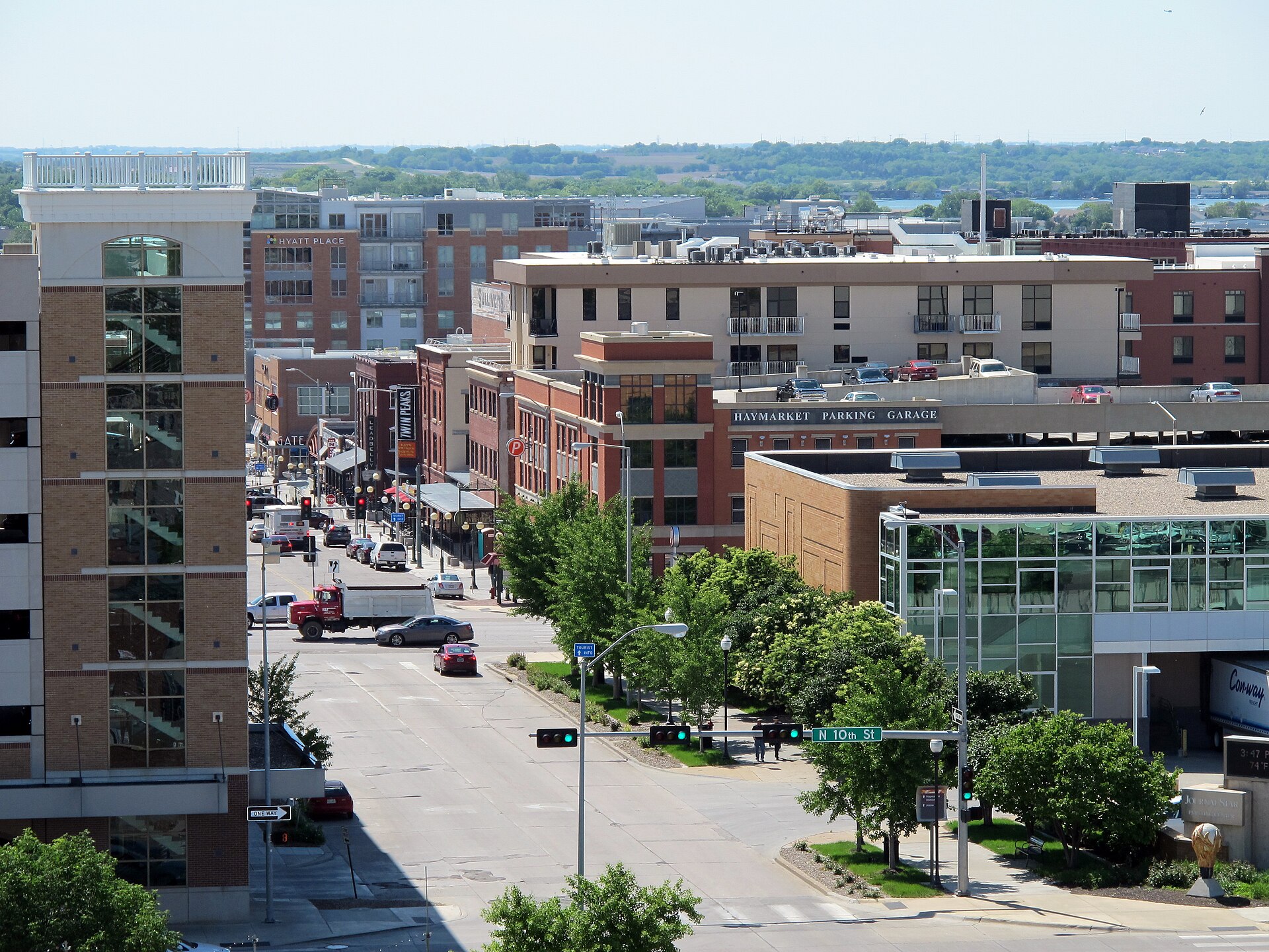
The Haymarket and West Haymarket from above

Outdoors

Picnic spots near Lincoln

Day-use and picnic areas near Lincoln on public land, from quick drives to full-day outings.

20picnic areas
3 mito the closest
10within 30 miles
April–June, August–Octoberbest months

Good to know: Group picnic sites can often be reserved; fire rules change with the season, so check before bringing a grill.

Closest picks

1

Holmes Lake

3 mi southeast · US Army Corps of Engineers

Holmes Lake, NE is a 112-acre lake located on Antelope Creek within the city of Lincoln, NE. Recreational opportunities at Holmes include fishing, hiking, biking, picnicking, and golfing. This park is managed by the City of Lincoln, NE.
2

Conestoga Lake

9 mi west · US Army Corps of Engineers

Conestoga Lake, NE is a State Recreation Area located 3 miles south and 1/2 mile west of Emerald. The 230-acre lake provides plenty of opportunity for boating and fishing.

Map of all 20 places

Map of 20 places loads as you scroll.

Within 30 miles (10)

3 mi southeast · US Army Corps of Engineers

Holmes Lake

Holmes Lake, NE is a 112-acre lake located on Antelope Creek within the city of Lincoln, NE. Recreational opportunities at Holmes include fishing, hiking, biking, picnicking, and golfing. This park is managed by the City of Lincoln, NE.

  • Boating
  • Fishing
  • Hiking
  • Nature education
  • Picnicking
  • Water sports
  • Wildlife viewing

9 mi west · US Army Corps of Engineers

Conestoga Lake

Conestoga Lake, NE is a State Recreation Area located 3 miles south and 1/2 mile west of Emerald. The 230-acre lake provides plenty of opportunity for boating and fishing.

  • Boating
  • Camping
  • Picnicking
  • Water sports
  • Wildlife viewing

10 mi west · US Army Corps of Engineers · Campground

Pawnee Dam-Site 14 Campground

This recreation area is part of Pawnee Lake

  • Camping
  • Fishing
  • Picnicking

10 mi west · US Army Corps of Engineers

Pawnee Lake

Pawnee Lake, NE is a State Recreation Area located about 12 miles west of downtown Lincoln, Nebraska and three miles northwest of Emerald, Nebraska just off I-80 at Exit 388.

  • Boating
  • Camping
  • Fishing
  • Nature education
  • Picnicking
  • Water sports
  • Wildlife viewing

14 mi southwest · US Army Corps of Engineers

Bluestem Lake

Bluestem Lake, NE is a State Recreation Area located just 2.5 miles west of Sprague, Nebraska and about 20 miles southwest of Lincoln, Nebraska. Bluestem Lake is 325 acres in size with 6 miles of shoreline.

  • Boating
  • Picnicking
  • Water sports
  • Wildlife viewing

14 mi northwest · US Army Corps of Engineers

Branched Oak Lake

Branched Oak, NE, a State Recreation Area located 4 miles west of Raymond, NE on Oak Creek, boasts some of the finest camping facilities in the State Park system. There are 268 campsites - 187 of which have electrical hook-ups.

  • Boating
  • Camping
  • Fishing
  • Hiking
  • Nature education
  • Picnicking
  • Water sports
  • Wildlife viewing

14 mi south · US Army Corps of Engineers

Stagecoach Lake

Stagecoach Lake, NE is a State Recreation Area located 1 mile south of Hickman, NE and resting on the south tributary of Hickman Branch.

  • Camping
  • Picnicking
  • Wildlife viewing

14 mi west · Bureau of Reclamation

Twin Lakes

Located 14 miles west of downtown Lincoln, northeast and 3 miles north of Pleasant Dale, NE. Take exit #388 from I-80.

  • Boating
  • Camping
  • Fishing
  • Hiking
  • History
  • Hunting
  • Picnicking
  • Ranger programs

14 mi south · US Army Corps of Engineers

Wagontrain Lake

Wagon Train Lake, NE, is a State Recreation Area located two miles east of Hickman. This 315-acre lake has a boat ramp and a dog training area.

  • Boating
  • Camping
  • Picnicking
  • Water sports
  • Wildlife viewing

18 mi southwest · US Army Corps of Engineers

Olive Creek Lake

Olive Creek, NE is a State Recreation Area located 1.5 miles east of Kramer, NE. Draining 8.2 square miles on the south tributary of Olive Branch Creek, this reservoir is 1.2 miles in length with 4 miles of shoreline.

  • Boating
  • Picnicking
  • Water sports
  • Wildlife viewing

30 to 75 miles (4)

37 mi south · National Park Service

Homestead National Historical Park

The Homestead Act of 1862 transformed the world. Millions were invited to file claims including families, women, immigrants, and formerly enslaved people. Over 10 percent of the United States was homesteaded!

  • Hiking
  • History
  • Picnicking
  • Wildlife viewing

39 mi northeast · US Army Corps of Engineers

Zorinsky Lake

Zorinsky Lake, NE, located in west Omaha, was named after the late U.S. Senator Edward Zorinsky.

  • Biking
  • Boating
  • Camping
  • Fishing
  • Hiking
  • Horseback riding
  • Nature education
  • Picnicking

58 mi northeast · Fish and Wildlife Service

Boyer Chute National Wildlife Refuge

Boyer Chute National Wildlife Refuge was established to recover fish and wildlife habitat in and along the Missouri River and to restore essential wildlife habitat that became scarce after the river was "improved" for navigation half a…

  • Archery
  • Biking
  • Birding
  • Cross Country Skiing
  • Educational Programs
  • Fishing
  • Hiking
  • Hunting

61 mi northeast · Fish and Wildlife Service

DeSoto National Wildlife Refuge

DeSoto National Wildlife Refuge was established in March of 1958 with the approval of the Migratory Bird Conservation Commission with the dual intention of providing for the needs of migratory birds and providing public recreation to local…

  • Archery
  • Biking
  • Birding
  • Boating
  • Educational Programs
  • Fishing
  • Hiking
  • History

75 miles and farther (6)

92 mi southeast · Fish and Wildlife Service

Loess Bluffs National Wildlife Refuge

Loess Bluffs National Wildlife Refuge is located in northwest Missouri, near Mound City.

  • Biking
  • Birding
  • Fishing
  • Hiking
  • Hunting
  • Photography
  • Picnicking
  • Ranger programs

95 mi southwest · Bureau of Reclamation

Lovewell Reservoir

Lovewell Reservoir is just inside the Kansas border from Superior, Nebraska. An historic school is now used as a church during the summer. Also, a cemetery from the 1860's is open to visitors.

  • Boating
  • Camping
  • Fishing
  • History
  • Hunting
  • Picnicking
  • Ranger programs
  • Recreational Vehicles

107 mi south · US Army Corps of Engineers

Tuttle Creek Lake

Situated in the scenic Flint Hills, Tuttle Creek Lake provides 12,500 surface acres of water and 100 miles of shoreline, making it the second largest lake in Kansas.

  • Biking
  • Boating
  • Camping
  • Fishing
  • Hiking
  • Horseback riding
  • Hotel/Lodge/Resort Privately Owned
  • Nature education

117 mi west · Bureau of Reclamation

Davis Creek Reservoir

Davis Creek Dam and Reservoir are features of the North Loup Division, Pick-Sloan Missouri Basin Program. Reservoir open 24 hours. Fair access roads.

  • Boating
  • Camping
  • Fishing
  • Horseback riding
  • Hunting
  • Picnicking
  • Water sports
  • Wildlife viewing

120 mi south · US Army Corps of Engineers

Milford Lake

The Milford Education Center and Fish Hatchery are located below the dam. From Topeka, 65 mi W on I-70, 5 mi N on US77, 2 mi W on K-57 hwy.

  • Biking
  • Boating
  • Camping
  • Fishing
  • Hiking
  • Horseback riding
  • Hotel/Lodge/Resort Privately Owned
  • Nature education

120 mi west · Bureau of Reclamation

Sherman Reservoir

Sherman Dam , Farwell Unit, P-SMBP , lies across Oak Creek, about 5 miles northeast of Loup City. Reservoir open 24 hours. Good access roads.

  • Biking
  • Boating
  • Camping
  • Fishing
  • Hunting
  • Picnicking
  • Recreational Vehicles
  • Water sports

Distances are straight-line miles from the center of Lincoln. Listings come from Recreation.gov’s federal recreation database; check each official page for hours, fees, fire restrictions and closures before you go.

Get outside around Lincoln

Around Lincoln

Hyde Memorial Observatory, Lincoln, Nebraska
20220427-Hyde-Memorial-ObservatoryMdahmke · CC BY-SA 4.0
Courtyard Nebraska State Capitol 2025b, Lincoln
Courtyard Nebraska State Capitol 2025bAntony-22 · CC BY-SA 4.0
College View Library, Lincoln
College View Librarydahusker · CC BY-SA 3.0

More outdoors near Lincoln

Questions

Where is the closest place for picnic spots near Lincoln?

Holmes Lake (US Army Corps of Engineers), about 3 miles southeast of Lincoln as the crow flies. Next are Conestoga Lake (9 mi) and Pawnee Dam-Site 14 Campground (10 mi).

When is the best time for picnic spots near Lincoln?

Based on Lincoln’s average highs, April–June, August–October. Conditions at higher elevations can be much cooler.

Who manages these places?

Federal agencies including US Army Corps of Engineers, Bureau of Reclamation, Fish and Wildlife Service. Each listing links to its official page for hours, fees, closures and current conditions.

Lincoln AI

Your Lincoln local guide
Hey there!

I'm Lincoln AI. Ask about neighborhood food, independent shops, local history or planning a visit.

AI recommendations may be inaccurate. Verify hours and prices. Questions are processed by Cloudflare. Privacy